Planning
Planning
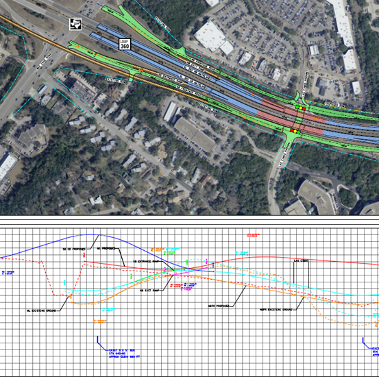
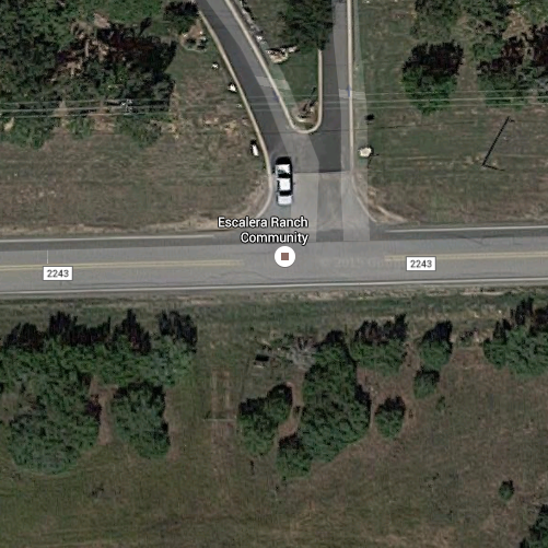
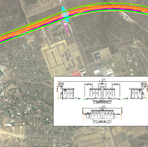
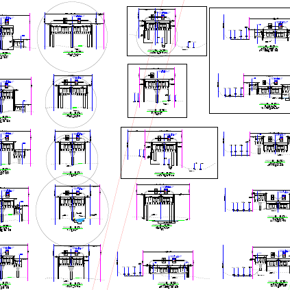
This SLG contract includes the preparation of Geometric Exhibits, Plans, Specifications and Estimates (PS&E) and related documents for the conversion of a four lane divided, at-grade facility to an access controlled mainlane and frontage road facility with grade separations at Westbank Dr. and Lost Creek Blvd. in Travis County. The project is located in extremely rolling terrain with multiple commercial and private access points. Specific task responsibilities include alignment creation for entire project limits, creation of a geometric schematic for public involvement, sheet creation for all parts of plan set development, annotation of all project details, creation of project cross-sections, creation of project specific details and quantification of all project bid items. In addition to the overall design of mainlanes, frontage roads, ramps, intersections and access points, roadway reconstruction elements include culverts and storm sewer, illumination, signals, retaining walls, grade separations, pedestrian accommodations, signing and striping. This project was deferred during the geometric schematic and public involvement phase.
This intersection improvement project, located within the Edwards Aquifer Recharge Zone, includes engineering services required for preliminary studies, plan preparation and construction support. Initially, a traffic study was conducted and a traffic analysis and summary report of alternatives to improve operations/safety at the intersection were prepared. This report presented a preferred engineering alternative as well as a signal warrant study. Utilizing survey, geotechnical, environmental and design services SLG prepared and presented a preferred alternative for approval and further development.
Project required design assistance for a Loop 20 expansion project from IH 35 to US 59 in Laredo. SLG assisted in development of route alternatives, design criteria and preliminary cost opinions; assisted in coordination with project stakeholders; reviewed existing and proposed ROW for compatibility with design and identified potential constraints; conducted design criteria analyses for the project limits; identified potential cost saving solutions; and prepared necessary presentation materials, reports and exhibits to support the above tasks.
Project required design assistance for a Loop 375, Border Highway West Extension Project from Racetrack Dr. to US 54 in El Paso. SLG provided alternative route studies and feasibility studies for portions of the project to ensure the best design was being carried forward; assisted in development of design criteria and preliminary engineering documents; assisted in coordination with project stakeholders including the BNSF Railroad, U.S. Customs and Border Protection and area utilities; assisted in determinations of limits of operations and maintenance; conducted design criteria analyses for the project limits; and identified potential cost saving solutions.
Project required design assistance and supplemental services under a procurement contract for the Loop 1604 Western Extension Project from FM 471 to SH 16. SLG evaluated alternate project configurations; reviewed existing and proposed ROW for compatibility with design and identified potential constraints; reviewed and updated probable construction and maintenance costs; and identified potential cost saving solutions.
This contract included PS&E services for the full reconstruction and extension of an urban section of SH 6 in the City of Gorman. The urban project runs from 0.18 mile north of Crescent St. to the Comanche County Line (a length of 1.3 miles). The existing two-lane with shoulders section is being replaced with an ultimate five-lane section that will initially be striped as a three-lane section with wide shoulders. Supplemental services are being provided that includes design of a detention pond and a 0.9 mile long “drainage diversion” storm sewer system to take runoff out of the city to alleviate low frequency rainfall flooding. Project, responsibilities include preliminary design for public presentations and PS&E design of all roadway reconstruction elements including storm sewer, cross-culverts, retaining walls, illumination, a flashing beacon, intersection improvements, pedestrian accommodations, signing and striping. The Sequence of Construction will break the project into manageable sections in order to maintain construction progress while reducing the impacts of long-term construction phases to local businesses. Extensive coordination with adjacent property owners has been undertaken due to ROW constraints and associated issues with driveway tie-ins.
Performed the engineering analysis and design of the proposed ITS and illumination systems for both an interim and an ultimate build condition from 2.68 miles north of Uniroyal Dr. to 1.2 miles north of US 83. The interim build schematic included the design of an ITS fiber optic conduit backbone system and proposed ITS devices consisting of CCTV, RSVD and a permanent loop detection traffic counting station. The interim illumination analysis and design include safety lighting using 50 ft conventional lighting poles at the entrance and exit ramps. The Ultimate build schematic involved adding Direct connectors from IH 35 to and from US 83. The ITS design for the ultimate build expanded to include additional CCTV and RSVD devices to monitor the traffic on the proposed DC ramps. The Ultimate illumination design consisted of analyzing the proposed interchange for illumination consisting of high mast illumination using 150 ft tall poles. Project is on hold. Future tasks will involve PS&E development of relevant design tasks for the project.
Schematic development of an existing 2-lane rural roadway to an ultimate 5 lane undivided roadway. Project limits are from IH 35 northbound frontage road to 1.31 miles east of CR 332, approximately 3.66 miles. This project involved Route Studies, Traffic Evaluations and Projections, ROW Mapping, Surveying, Preliminary and Final Schematic and Cost Estimate, Drainage Study, Environmental, Geotechnical.
Schematic development of an existing 2-lane rural roadway to an ultimate 4 lane undivided roadway. Project limits are from CR 313 to FM 486, approximately 1.1-mile-long project. The project involved Route Studies, Traffic Evaluations and Projections, ROW Mapping, Surveying, Preliminary and Final Schematic and Cost Estimate, Drainage Study, Environmental, Geotechnical.
Schematic development of an existing 2-lane rural roadway to an ultimate 6 lane median divided roadway. PS&E development for reconstruction and extension of an adjacent 2-lane roadway. Project limits are from CR 254 to Ronald Reagan Blvd, approximately 2.9-mile-long project. The project involved Route Studies, ROW Mapping, Surveying, Preliminary and Final Schematic and Cost Estimate, Drainage Study, Environmental, Geotechnical.