PS&E Projects
PS&E Projects
Project Task Leader (Traffic Control and Construction Sequencing) – The limits of this IH 35 reconstruction project were from Rundberg lane to US 290E (approximately 2.35 miles). Interchange improvements at IH-35 and US 183 are intended to alleviate traffic congestion and provide better access from one highway to the other. The TxDOT-funded interchange project consists of three new direct connector bridge structures, reconstruction of one existing direct connector bridge entrance, reconstruction of an existing bridge at St. Johns plus two new adjacent turn-around bridges, construction of new MSE and soil nail retaining walls, improved lower roadways, collector-distributor roads under St. Johns and new shared use paths (SUP’s) along the frontage roads to improve the mobility options and safety for pedestrians and cyclists.
This SLG contract contains four separate PS&E packages consisting of six different CSJ’s. Preparation of PS&E and related documents is being provided for the preventative maintenance and roadway restoration at the six locations throughout the Waco District. Specific task responsibilities include alignment creation for each CSJ, sheet creation for all parts of plan set development, annotation of all project details, creation of project specific details and quantification of all project bid items. In some sections, roadway reconstruction elements include pedestrian accommodations.
Project Task Leader (Signing and Pavement Markings) – Provided engineering services for the preparation of PS&E and related documents for IH 20 from CR 3151 to SH 137 in Stanton (approx. 3 miles). The project involves roadway and ramp upgrades and reversing a bridge configuration to take the interstate over a frontage road connection. Specific tasks for this project included signing and pavement markings (including development of large sign details).
Project Task Support (Signals) – Provided engineering services for the preparation of PS&E and related documents for the upgrade of traffic signals at three intersections in Corpus Christi. The project involved replacing signal heads, pushbuttons, wiring controller and detection equipment at existing locations. In addition, one intersection required the replacement of two of the four signal mast arm due to impact damage. Replacing these poles required a field assessment of project site to locate poles to avoid utilities, use standard size poles and arms, and comply with ADA.
Project Task Leader (Pavement Markings, TCP, Erosion Control) – The work performed under this contract consisted of providing engineering services required for the preparation of plans, specifications and estimates (PS&E) and related documents, for a seal and overlay project along SL 340 in McLennan County from SP 484 to Williams Road for approximately 3.5 miles. The work included Traffic Control Design, Pavement Markings and completion of the SW3P.
Project Task Leader (Pavement Markings, TCP, Erosion Control) – Provided engineering services for the preparation of PS&E and related documents for two mill and overlay projects in Taylor County: SH 36 from Treadway Blvd. to Judge Ely Blvd. (approx. 1.3 miles) and FM 1750 from SH 36 to LP 322 (approx. 1.9 miles). Specific tasks for this project included signing and pavement markings, a traffic control plan and the erosion control plan.
Prime Provider – This contract contained two separate PS&E packages. One for the creation of three separate passing lane areas (Super2 Design) and one for full reconstruction and extension of an urban section in the City of Gorman. The limits of the Super2 project are from IH 10 to 0.18 mile north of Crescent St. in Gorman (a length of 17.2 miles). The Gorman urban project runs from 0.18 mile north of Crescent St. to the Comanche County Line (a length of 1.3 miles). Super 2 design included passing lane design, cross-culvert and parallel drainage safety improvements. In the urban section of the project, responsibilities include preliminary design for public presentations and PS&E design of all roadway reconstruction elements including storm sewer, illumination, flashing beacon, pedestrian accommodations, signing and striping.
Prime Provider – This PS&E project consists of the rehabilitation of existing FM 3338 in Webb County from FM 1472 to SH 255, approximately 8.195 miles, in order to accommodate increased truck traffic and load limits. Project included roadway and traffic design, extending culverts, construction phasing and TCP, SW3P, utility coordination and preparation of PS&E documents.
Project Task Leader (Erosion Control) – Existing FM 1110 in El Paso County is to be upgraded from a two-lane rural facility to a four-lane urban roadway between IH 10 and FM 76 (approx. 1.1 miles). Specific tasks for this project included development of PS&E for a complete erosion control plan.
Prime Provider – This contract contained two separate PS&E packages. One for grading, structures, base repair and widening in Cherokee County and one for full reconstruction and widening of the road base and structures of US 84 in Rusk County. The limits of the Cherokee County project are from 0.43 mile east of SH 110 to the Rusk County Line in Reklaw (a length of 9.33 miles). The Rusk County project runs from FM 225 to approximately 2.34 mile west of FM 3055 (CR 3155) (a length of 4.525 miles). Existing US 84 is only 24 ft. wide (11 ft. lanes and 1 ft. shoulders) in rolling terrain. Plans were developed to widen to a 28 ft. roadway in order to provide 3 ft. shoulders and an improved ride. All existing structures (including driveway culverts) were widened and/or replaced as necessary and safety end treated. Traffic control plans for phased construction were developed, pavement marking and signing plans were prepared and quantities and cost estimates were calculated.
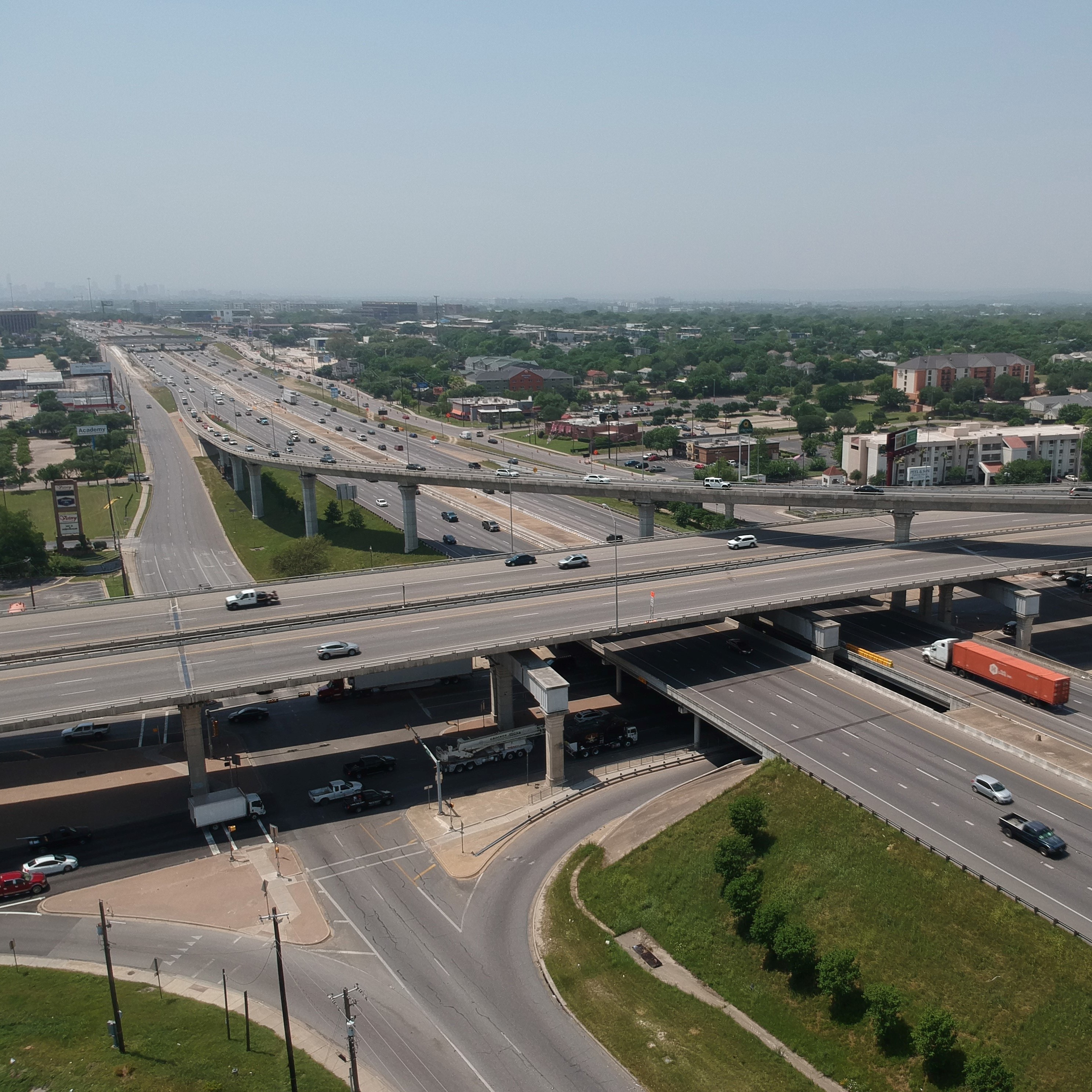
This intersection improvement project, located within the Edwards Aquifer Recharge Zone, includes engineering services required for preliminary studies, plan preparation and construction support. Initially, a traffic study will be conducted and a traffic analysis and summary report of alternatives to improve operations/safety at the intersection will be prepared. This report will present a preferred engineering alternative as well as a signal warrant study if needed. Next, survey, geotechnical, environmental and design services will be used to further develop the preferred alternative, coordinate proposed improvements with TxDOT, TCEQ and other agencies, and prepare a complete PS&E package to be put out to bid. After providing bid phase assistance, construction support in the form of responses to contractor requests for information and shop drawing review will be provided.
Signing, pavement markings and erosion control – This 1.2-mile intersection and roadway improvement project, located within the Edwards Aquifer Recharge Zone, includes engineering services required for preliminary studies, plan preparation and construction support. Design tasks for this project including development of PS&E for all required roadway signing and pavement markings as well a complete erosion control plan for the project.
Known as the 411 Main Project, this consisted of the extension of San Saba Street for a half-block to provide parking, sidewalks, streetlights, landscaping and other aesthetic features as part of improvements in downtown Round Rock. The proposed improvements included the design of ADA elements and design of a winding access driveway into a proposed commercial development. Components of this PS&E project included grading, paving, sidewalks and ramps utilizing paver blocks, illumination, irrigation, signing and striping.
Provided design services and coordination efforts with development engineers and TxDOT to secure approval for a turn lane and access driveway for the Shops at 685 development. Project included ROW dedication determinations, environmental documentation, utility identification and coordination for relocation efforts, roadway design, storm sewer design, traffic control plans and completed permit request with required information.
Provided design services and coordination efforts with development engineers and TxDOT to secure approval for a turn lane and access driveway for the Manor Commons development.
Signing, pavement markings and illumination – To provide for increased development in the NW Round Rock area, Seton Parkway is being improved and extended between University Blvd. and Avery-Nelson Pkwy. Within the project limits, a new east-west connection will also be designed to connect Seton Pkwy. with A.W. Grimes Blvd. Design tasks for this project including development of PS&E for all required roadway signing and pavement markings as well as complete design of continuous illumination for the project.
Intersection details and erosion control – Located in Lockhart, this 2.02-mile improvement project will widen the existing four-lane undivided roadway to four lanes with a continuous left turn lane. Design tasks include curb and gutter, storm sewer, intersection/signal design, safety lighting and pedestrian elements. Specific responsibilities under this project included the production of project layouts, creation of intersection detail sheets and design and detailing of erosion control measures.
This 3.4-mile project is situated between two major, State maintained roadways; FM 1460 and SH 130. The work performed consists of providing engineering services required for the preparation of PS&E for the addition of lanes and shoulders to an existing two-lane roadway to create a predominantly four-lane divided facility. Preparation of plans, details and quantities include roadway design, grading, paving, drainage, signing, pavement markings, signals, traffic control plans and construction cost opinions for the proposed west bound lanes and the overlay of the existing east bound lanes. This is a County sponsored project, but all work required coordination with TxDOT and the City of Round Rock.
Large signs – This project entails the reversal of the existing ramp patterns along IH35 between FM3406 (Old Settlers Blvd.) and US79 (Palm Valley/Sam Bass Road) to increase economic development. Improvements will better accommodate access to the increasing number of businesses along the frontage roads. The IH35 ramp relocation project brings a unique set of project requirements and challenges. Being part of the Federal Highway System and being located in an important growth and mobility corridor, project components must be dissected on multiple levels. Alternatives studied balanced access needs not only for the interstate system but also for the many local businesses; all while maximizing safety. Specific responsibilities on this project included general roadway design support and the design and detailing of guide signs and sign structures.
This project consisted of the widening of Gattis School Road from west of Rolling Ridge Drive to west of Via Sonoma Trail (0.5 mile). The proposed improvements include curb removals, sidewalk relocation and re-striping to accommodate the addition of a two-way left turn lane for local access. Components of this PS&E project included grading, paving, sidewalks, storm sewer revisions, signing and striping.
Signing and pavement markings – Tagged as a safety improvement project, the FM 3406 improvements will widen the existing pavement intermittently from Sam Bass Road to North Mays Street to provide left- and right-turn lanes at key intersections. Specific responsibilities on this project include all necessary engineering and technical services for the completion of signing and striping plans for the project.
Drainage – Quinlan Park Road, located in Travis County’s Precinct 3, is a two-lane rural roadway with left turn bays at Bella Mar Trail and Tierra Grande Trail. This project will widen Quinlan Park Road in front of River Ridge Elementary School to provide a continuous left turn lane throughout the project limits, a distance of approximately 1800’. Specific project related responsibilities include drainage area boundaries and hydrologic calculations for existing and proposed conditions, determination of Total Suspended Solids removal and preparation of a hydraulic report summarizing methodology used in all analyses.
This project consisted of the reconfiguration of the north and south approaches of Greenlawn Blvd. at Gattis School Road. The proposed improvements include median and striping removals to accommodate the addition of dedicated left turn lanes for both approaches. Additionally, revisions to curb lines and lane configurations on the south approach were made to accommodate a hike/bike trail for inclusion in an existing system.
The limits of design for Mager Lane improvements are from FM 1660 to the east City Limits of Hutto. With current and projected land use being predominantly mid-density residential and commercial, this two-lane rural roadway needs to be upgraded to provide for future growth and traffic demands. Additionally, because Mager is a key school route to Hutto Elementary from Clark’s Crossing, Carol Meadows and other nearby subdivisions, this section of roadway has been identified as the number one priority in Hutto’s 2010 Pedestrian Mobility Plan. The proposed section for this project is a three-lane urban facility with underground storm sewer and sidewalks. A right turn lane into the school will also be designed to ease congestion during morning drop-off and afternoon pick-up periods. Project elements included right of way acquisition, utility coordination and adjustments, pavement design, storm sewer design, floodplain mapping and revisions, culvert design and channel improvements as well as normal roadway design tasks.
This shopping area along the Loop 1 (Mopac Expressway) near US 183 in Travis County created congestion issues on the northbound frontage road due to patron traffic at the center’s access points. As a joint effort between TxDOT, the City of Austin and the developer, frontage road improvements including widening and re-striping to create acceleration and right turn only lanes for the shop’s access driveways were designed. Tasks include geometric layouts, roadway design, drainage design and striping plans compatible with the existing frontage road and meeting all TxDOT design requirements.
The LBJ Express project incorporates dramatic improvements to Interstate 635 and Interstate 35E in Dallas County. This innovative project features rebuilt main lanes, a continuous frontage road system, and 13 miles of new express managed toll lanes. SLG managed traffic data collection and traffic modeling efforts to build and validate an existing conditions Synchro model to be used for additional services. These additional services include (1) claim assessments to collect new and analyze new traffic data as necessary to determine whether damages were incurred as a result of construction activity, (2) intersection traffic analysis to assess the effects of temporary closures of transverse intersecting roadways along the project, and (3) traffic management plan analysis in order to study and propose alternatives for potential cost or time savings for different traffic management strategies.
This intersection ranked as the most accident-prone intersection in San Antonio and Bexar County for a number of years because of the stop and go traffic and the sheer volume of cars trying to access US 281 and/or Loop 1604. The solution; four non-toll direct connectors linking US 281 and Loop 1604. SLG took on PS&E development for two pedestrian bridges over US 281 at the interchange with LP 1604. Initial tasks included design reviews including utility conflict determinations and an overall compatibility review of proposed improvements within an existing interchange reconstruction project. Plan sheets were developed for the proposed bridges, drainage improvements, traffic control and all other associated design elements. Plan preparation also included quantity summaries and incorporation of applicable specifications, notes and standards.
IH 35 is being expanded from four to six lanes from the Williamson County line to just north of Hillsboro. The project will be financed through Proposition 12 and Proposition 14 funds and the American Recovery and Reinvestment Act. SLG provided Quality Control services for Segment 3 by reviewing and commenting on the extensive traffic control plans being developed for this project. SLG also provided drainage design services for temporary structures needed to maintain project drainage through various phases of construction.
During relatively intense rain events, Oakridge Drive in the vicinity of Chisholm Trail Middle School (approximately 1000 feet west of Deep Wood Drive) experienced inundation that hindered traffic or even completely blocked the road. Additionally, storm water at times overwhelmed the culvert capacity under Creekview Drive near the Round Rock West Greenbelt (approximately 300 feet west of Deep Wood Drive) causing inundation of the road and flooding of adjacent property. The purpose of this project was to reduce the street inundation/property flooding frequency at these two locations. SLG determined the most feasible, cost effective solution for these flooding issues by analyzing and modeling the existing drainage conditions and looking at possible alternatives. Ultimately, the solution was presented to the City for concurrence and PS&E documents were developed for construction.
Provided design services and coordination efforts with development engineers and TxDOT to secure approval for a commercial access driveway with a dedicated turn lane and a High-T intersection design for a new city street that will serve as access to a proposed development. With the High-T design, a right turn deceleration lane, a left turn deceleration lane and a left turn acceleration lane were all designed to TxDOT standards. Before completion of PS&E, this intersection was redesigned as a conventional four-leg with turn lanes and signals. Project included ROW dedication determinations, environmental documentation (a categorical exclusion), development of a Donation Agreement, utility identification and coordination for relocation efforts, roadway design, storm sewer design, signal design, traffic control plans and completed permit request with required information. Being a TxDOT let project, General Notes and Specifications and a construction estimate using TxDOT bid items were created and submitted. The commercial access driveway was constructed but the new intersection construction was placed on hold..
Provided design services and coordination efforts with development engineers and TxDOT to secure approval for four, right-in/right-out access points to a proposed development. Project included ROW dedication determinations, environmental documentation (categorical exclusions), TCEQ coordination, Donation Agreements, utility identification and coordination for relocation efforts, roadway design, storm sewer design, signal design, traffic control plans and completed permit request with required information. Right turn access lanes were designed at three locations to accommodate driveway turning movements. General Notes and Specifications and a construction estimate using TxDOT bid items were created and submitted.
This contract included PS&E services for the full reconstruction and extension of an urban section of SH 6 in the City of Gorman. The urban project runs from 0.18 mile north of Crescent St. to the Comanche County Line (a length of 1.3 miles). The existing two-lane with shoulders section is being replaced with an ultimate five-lane section that will initially be striped as a three-lane section with wide shoulders. Supplemental services are being provided that includes design of a detention pond and a 0.9 mile long “drainage diversion” storm sewer system to take runoff out of the city to alleviate low frequency rainfall flooding. Project, responsibilities include preliminary design for public presentations and PS&E design of all roadway reconstruction elements including storm sewer, cross-culverts, retaining walls, illumination, a flashing beacon, intersection improvements, pedestrian accommodations, signing and striping. The Sequence of Construction will break the project into manageable sections in order to maintain construction progress while reducing the impacts of long-term construction phases to local businesses. Extensive coordination with adjacent property owners has been undertaken due to ROW constraints and associated issues with driveway tie-ins.
Project design involved the construction of 4-lane tolled expressway within the median section of the existing US 183/183A corridor from just north of Hero Way to just north of CR 258/CR 213 (approximately 6 miles). This route will be signed as 183A and includes grade separations and improvements to SH 29 and other cross streets. The proposed improvements are designed with allowance for the ultimate planned improvements to 183A including the addition of a third tolled lane to the inside of the proposed 4-lane section. Specific responsibilities for this project included design of complex traffic strategies to ensure the safety of the travelling public while providing for good construction progression for expedited delivery. SLG coordinated efforts of various disciplines (bridge, drainage, ITS, etc.) to ensure constructability while providing a sequencing scheme to allow various projects elements to be constructed in such a manner as to meet a strict construction timeline. Traffic control considerations included utility relocation efforts, maintaining access to local businesses and subdivisions, accommodating a school bus route and ensuring mobility and safety for the intermingling of passenger and large truck traffic.
Provided design services and coordination efforts with development engineers and TxDOT to secure approval for the redesign of two intersections (US 290/FM 973 and FM 973 at Old HWY 20), the addition of a signal at Ring Road and a commercial driveway access. Widening and turn lane design plans were prepared for the north and south approaches to US 290 along FM 973 and for the southbound approach of FM 973 at Old HWY 20. Project included ROW dedication determinations, environmental documentation, a Donation Agreement, utility identification and coordination for relocation efforts, roadway design, signal design, traffic control plans and completed permit request with required information. General Notes and Specifications and a construction estimate using TxDOT bid items were created and submitted for review. Services extended into construction where periodic inspection services are being performed and reported to TxDOT.
Performed the engineering analysis and design of the proposed ITS and illumination systems for both an interim and an ultimate build condition from 2.68 miles north of Uniroyal Dr. to 1.2 miles north of US 83. The interim build schematic included the design of an ITS fiber optic conduit backbone system and proposed ITS devices consisting of CCTV, RSVD and a permanent loop detection traffic counting station. The interim illumination analysis and design include safety lighting using 50 ft conventional lighting poles at the entrance and exit ramps. The Ultimate build schematic involved adding Direct connectors from IH 35 to and from US 83. The ITS design for the ultimate build expanded to include additional CCTV and RSVD devices to monitor the traffic on the proposed DC ramps. The Ultimate illumination design consisted of analyzing the proposed interchange for illumination consisting of high mast illumination using 150 ft tall poles. Project is on hold. Future tasks will involve PS&E development of relevant design tasks for the project.
Provided engineering services for the preparation of PS&E and related documents for the reconstruction of grade separations and frontage roads on IH35E between Corporate Drive and SH 121 Business in Denton County. The project involves changing the IH35 underpass at Corporate Dr. to an overpass and reconstructing the overpass at SH 121 Business. This included relocation of freeway ramps and total reconstruction of interstate mainlanes and frontage roads. Specific tasks for this project included signing and pavement markings (including development of large sign details) and development of phased, stormwater pollution prevention plans to accommodate construction.
Provided engineering services for the preparation of PS&E and related documents for the reconstruction of grade separations and frontage roads on SH 114 from west of IH 35W to west of US 377 in Denton County. Specific tasks for this project included signing and pavement markings and development of phased, stormwater pollution prevention plans to accommodate construction.
Provided engineering services for the preparation of PS&E and related documents for five safety improvement locations in the Tyler District consisting of sidewalks, crosswalks, pedestrian ramps and pedestrian signals meeting ADAAG requirements and AASHTO and PROWAG guidelines (over a mile of improvements in total). Along with sidewalk and ramp details, tasks for this project included construction easement determinations to accommodate driveway reconstruction, utility coordination, a suggested sequence of construction, stormwater pollution prevention plans, signing and pavement markings.
Schematic development of an existing 2-lane rural roadway to an ultimate 5 lane undivided roadway. Project limits are from IH 35 northbound frontage road to 1.31 miles east of CR 332, approximately 3.66 miles. This project involved Route Studies, Traffic Evaluations and Projections, ROW Mapping, Surveying, Preliminary and Final Schematic and Cost Estimate, Drainage Study, Environmental, Geotechnical.
Schematic development of an existing 2-lane rural roadway to an ultimate 4 lane undivided roadway. Project limits are from CR 313 to FM 486, approximately 1.1-mile-long project. The project involved Route Studies, Traffic Evaluations and Projections, ROW Mapping, Surveying, Preliminary and Final Schematic and Cost Estimate, Drainage Study, Environmental, Geotechnical.
This contract includes PS&E services for the widening and reconstruction of SH 16 between FM 1480 and the Mills County Line (10.4 miles). Design is to accommodate the creation of passing lane areas (Super2 Design). The project includes PS&E design of all roadway reconstruction elements including traffic control, cross-culverts, bridge class structure rail upgrades, driveway and intersection improvements, stormwater pollution prevention plans, signing and pavement markings. Additional project tasks include environmental study review, ROW evaluations, subsurface utility engineering, utility adjustment coordination, geotechnical borings and investigations, constructability reviews, project cost estimates, contract time determinations and preparation of project specific specifications and general notes. After project letting, construction phase services will begin.
Preparation of PS&E and related documents for the placement of LED Chevrons and advance warning signs at identified curve locations in the Tyler District. Along with sign layout sheets, this project included identifying limits of ROW preparation, utility coordination, and a simplified stormwater pollution prevention plan.
PS&E development for the widening of an existing 2-lane urban and rural roadway to a 6-lane divided (raised median) facility in Hidalgo County. Project limits are from Wallace Road to McColl Road, approximately 4.4-miles. The project includes PS&E design of all roadway reconstruction elements including traffic control, storm sewer, potential sound walls, signals, intersection improvements, pedestrian accommodations, stormwater pollution prevention plans, signing and pavement markings. Additional project tasks will include environmental study reviews, ROW evaluations, utility adjustment coordination, geotechnical borings and investigations, constructability reviews, project cost estimates, contract time determinations and preparation of project specific specifications and general notes. After project letting, construction phase services will begin
US 181 to SH 123 (approx. 5.16 miles). 6” overlay with notch and mill at bridges. Culvert extensions, ditch rework, driveway and side street reconstruction, mailboxes, sign and pavement markings.
Schematic development of an existing 2-lane rural roadway to an ultimate 6 lane median divided roadway. PS&E development for reconstruction and extension of an adjacent 2-lane roadway. Project limits are from CR 254 to Ronald Reagan Blvd, approximately 2.9-mile-long project. The project involved Route Studies, ROW Mapping, Surveying, Preliminary and Final Schematic and Cost Estimate, Drainage Study, Environmental, Geotechnical
Provided engineering services for the preparation of PS&E and related documents for the construction of safety improvements consisting of shoulder widening, milling and inlay, hydrologic and hydraulic analysis, box culverts extensions, pavement marking and signing, traffic control plan and SW3P. The PS&E includes 7.9 miles of FM 547 from US 380 to FM 6; 3.4 miles of FM 1777 from FM 6 to CR 677 and 2.6 miles of FM 1777 from CR 677 to SH 66 in Collin County.
Provided engineering services for the preparation of PS&E and related documents for the construction of safety improvements consisting of widening of the existing pavement to provide for continuous two-way left turn lanes. The PS&E includes 1.6 miles of SH 198 from north of US 175 to FM 3080 and 1.2 miles of SH 243 from SH 34 to FM 2727 in Kaufman County.
Providing engineering services for the preparation of PS&E and related documents for the construction a new location freeway from Airport Drive to US 380 in Collin County. Specific tasks for this project included cross culvert plan and profile design, signing (small and large including large sign structure design) and pavement markings, and development of phased, stormwater pollution prevention plans to accommodate construction.
Provided engineering services for the preparation of PS&E and related documents for the reconstruction of an interchange at US83/84 and constructing a widened section and a Super-2 section for US 83. Specific tasks for this project included pedestrian and bicycle facility design and signing and pavement markings.